Counting Raindrops with a Capacitor: The 25square Sensor, Its STM32, and the Patent Behind It
Stephan BökelmannWhen people talk about AI-based heavy-rain forecasting, the conversation usually starts at the model: data fusion, neural networks, nowcasting. It rarely starts where the water actually hits: at the sensor. But a model is only as good as its ground truth, and for street-level rain nowcasting in a city, that ground truth simply did not exist in 2020. Weather radar sees clouds from above; a municipal network of one or two calibrated gauges sees almost nothing of a convective cell that dumps its load on six street blocks and misses the rest of the city entirely.
25square set out to fix that: a research project funded through the mFUND programme of the German federal ministry of transport (our sub-project at Auto-Intern ran under grant 19F1064B), started in August 2020 together with Okeanos, then still Okeanos Consulting, founded by Dr. Henning Oppel and Dr. Benjamin Mewes, and the Bochumer Institut für Technologie. The name is the grid: one sensor per quarter square kilometre. For Bochum’s 145 km² that meant a target of roughly 580 sensors, dense enough that a rain cell cannot sneak between the measurement points. Okeanos built the models and the GIS pipeline; BO-I-T ran the server infrastructure; and at Auto-Intern we built the sensors, with Tabea Bökelmann (then Röthemeyer) as project lead, Odin Holmes on hardware and bare-metal firmware, and me on system architecture and the path from the sensor into the backend.
The project start was announced in a joint press release of the three partners, published by the ministry: Forschungsprojekt 25square: Starkregenvorhersage durch den Einsatz günstiger autarker Messzellen (PDF, German; archived copy).
Why not a tipping bucket, and why not a piezo either
The classic rain gauge is a tipping bucket: water collects in a funnel, a see-saw flips every 0.1 mm or so, a reed contact counts the flips. It is wonderfully simple and completely unsuitable for nowcasting. It integrates, so you learn that it has rained, minutes late, in coarse quanta. It clogs with leaves, and it needs cleaning on a schedule that no one who plans to deploy 580 of them wants to think about.
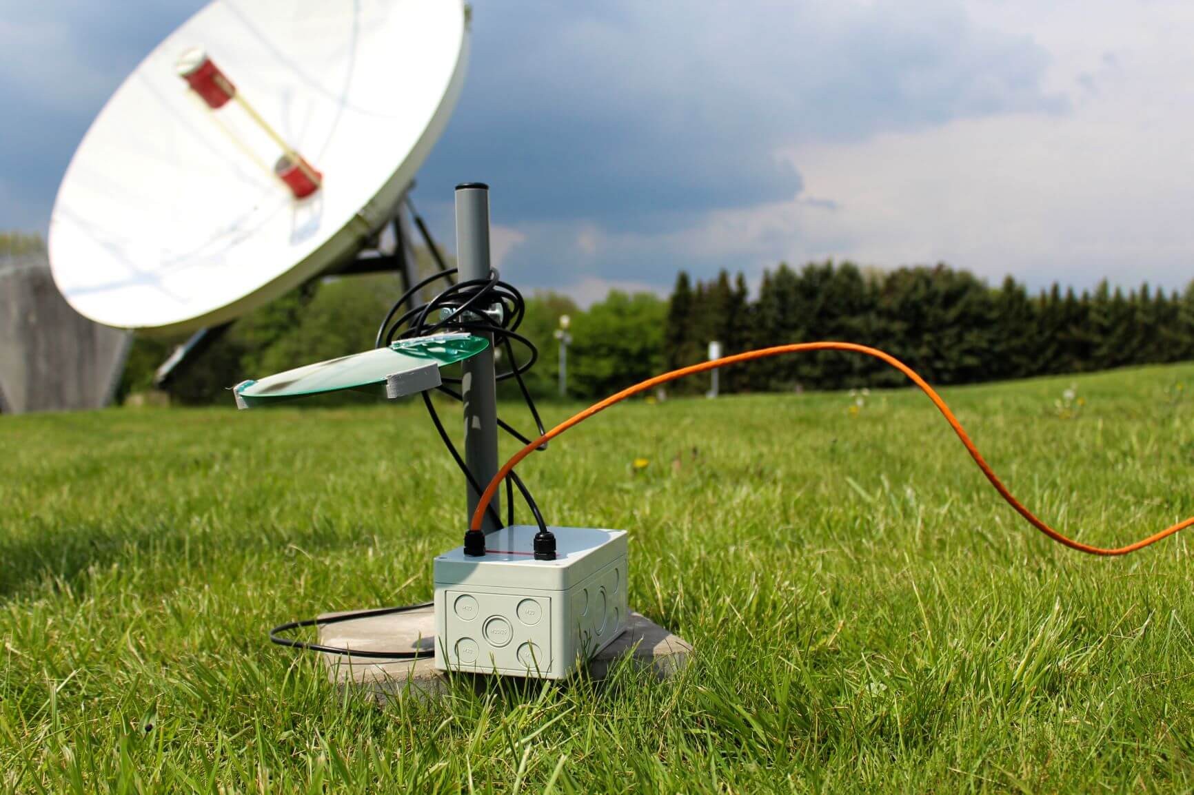
So we measured the raindrops themselves. Every drop arrives with kinetic energy, and if you let it hit a plate, that impact is a measurable event. The obvious first idea is a piezo disc glued to the plate: drop hits, crystal produces a voltage spike, count the spikes and weigh them by amplitude. We ended up somewhere else: the production sensor works capacitively. The impact plate is a freely oscillating plate mounted at a defined distance above a fixed base plate; the two form a capacitor. A drop strike makes the plate ring, the gap modulates, the capacitance modulates with it, and an oscillator built around an op-amp stage turns that into a frequency shift that the microcontroller can track with nothing more exotic than its timers. We took that route for a plain engineering reason: it worked considerably more stably in the field. A frequency is a robust thing to measure. You count edges instead of shepherding a microvolt-level charge signal through an amplifier chain that also hears wind, hail on the mast, and every lorry on the nearby road. The discrimination between a drizzle droplet, a fat convective drop, and a hailstone falls out of the impulse signature; timestamping happens at the sensor, microsecond-accurate, at the source, which regular readers will recognise as the hill I am happy to die on where decentralised DAQ is concerned.
One STM32, two ways out of the box
Electrically the sensor is deliberately boring: an STM32 does everything. It runs the oscillator measurement, filters and classifies the impact events, aggregates them into per-interval intensity figures, and speaks to the outside world. What varied was the outside world, and we built two variants:
- PoE + Ethernet. For sites with infrastructure, such as the observatory, fire stations and public buildings, power and data share one cable. The STM32 runs lwIP directly on the metal, no operating system underneath, with an MQTT client on top. Every few seconds the sensor publishes its aggregated event data, timestamped at the source.
- LoRa. For lampposts and field sites without a network drop, the same STM32 design instead feeds a LoRa radio, running from battery and a small photovoltaic panel, autonomously for months. Coarser reporting intervals, same measurement core.
The choice to keep the network stack tiny and deterministic was not aesthetic. A sensor that is supposed to sit on a roof for years, through storms it is itself reporting on, has no business running a full OS whose failure modes nobody has enumerated.
The receiving side is a piece of history I am fond of: the gateway and server that collected the MQTT streams were a direct evolution of the server we had built for railway-switch diagnostics in Deutsche Bahn’s DIANA programme, and what we learned running this fleet fed straight into what became the skAInet Edge-Compute. If you put the three systems side by side you can watch the same architecture grow up: DIANA taught us to collect decentralised measurements reliably, 25square taught us to do it cheaply and at city scale, and the Edge-Compute is the productised answer to both.
From the gateway onwards it was Okeanos territory: the streams land in a geoinformation system, get fused with the DWD’s radar picture, and feed the machine-learning model that turns a field of point measurements into a moving picture of the rain cell: where it is, how intense, and which way it is drifting. The promise on the tin: a street-accurate warning up to 60 minutes ahead.
Did it measure anything? Yes, more than the official numbers
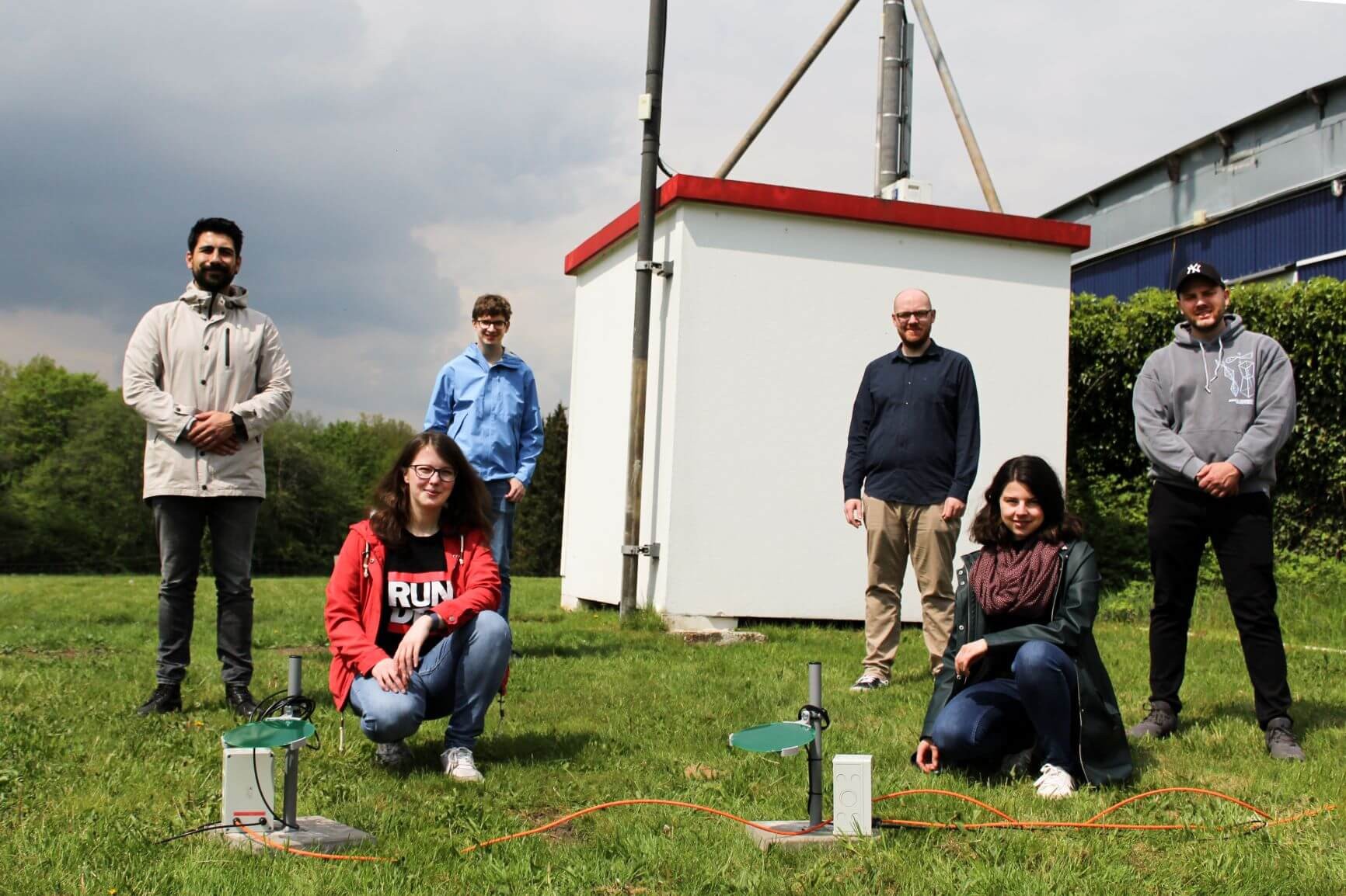
The first two sensors went into the lawn of the IUZ Sternwarte Bochum in May 2021, with the local fire brigade offering station roofs for the next batch; about 15 sites were eventually equipped. The most satisfying early result came in July 2021, when our little plates recorded around 105 l/m² during the storms that summer while the publicly available figure for Bochum stood at 60 l/m²: exactly the gap between “a gauge somewhere in the city” and “a sensor on your street” that the project existed to demonstrate. We never needed the full 580: the grid of deployed sensors was enough to validate the measurement principle, the network design, and the models against reality.
The patent
The measurement principle and the spatially-resolved analysis on top of it became a patent, and it is a genuinely joint one: DE 10 2020 119 488 B4, “Verfahren und System zur Analyse von Niederschlagsereignissen sowie Computerprogrammprodukt und Verwendung”, filed on 23 July 2020, granted in December 2022, with the opposition period passing in late 2023 without a single objection. The named inventors are Odin Holmes, Benjamin Mewes, Henning Oppel, Tabea Röthemeyer, and me; it is held 50/50 by Okeanos Smart Data Solutions and Auto-Intern GmbH; the split mirrors how the work was actually done, physics and hardware on one side, hydrology and models on the other. Alongside the patent there is a parallel utility model, and both are still maintained.

The full patent specification is public; here it is, if you want the claims in their bureaucratic glory (the freely oscillating plate is in claim 1):
⬇️ Download the patent DE 10 2020 119 488 B4 (PDF) · View on Google Patents
Who did what
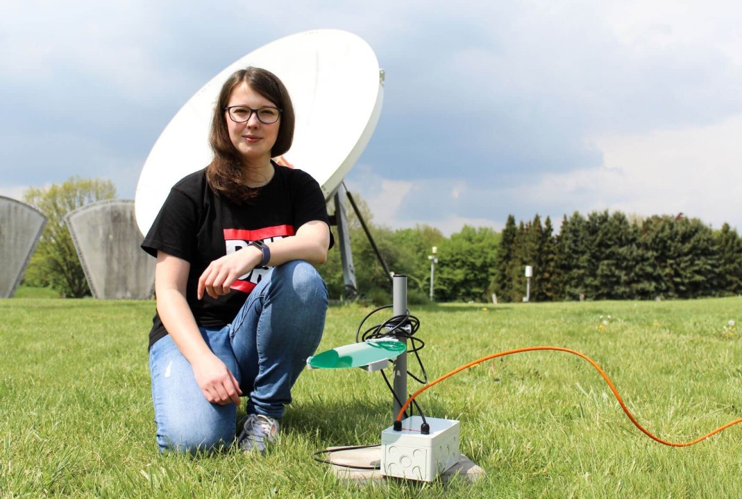
Since patents and press releases both have a way of flattening teams into logos, here is the honest version. Tabea led the project at Auto-Intern; hers is the coordination that got sensors from bench to rooftop, and she designed and built a solid part of the software along the way; she also told the story publicly at the time in the AI-Gruppe’s LinkedIn article, which is where the photos in this post come from. Odin did what Odin does: the hardware design and the bare-metal firmware discipline that lets an STM32 run a network stack without an OS safety net. I owned the system architecture: the sensor-to-backend chain, the two connectivity variants, the decision to timestamp at the source, and the software path from the MQTT ingest into the storage and the interfaces Okeanos consumed: the same decentralised-DAQ pattern I keep coming back to in measurement projects since. Benjamin and Henning turned all of it into hydrology: the GIS integration, the radar fusion, and the nowcasting models that made the sensor grid mean something.
What became of it
For us at Auto-Intern, 25square ended the way a good research project should: we had learned everything we set out to learn. The capacitive measurement principle was validated, the patent was granted, and the architecture lessons were already flowing into the M12-PoE platform that became the Edge-Compute. So when the follow-up project was taking shape, we passed the baton and turned our attention there. Okeanos carried the mission forward, and did it well: in heavyRAIN (mFUND, September 2022 to August 2025, together with hydro & meteo, BO-I-T and LANUK NRW) they scaled the idea to four cities (Bochum, Hagen, Lüdenscheid and Lübeck), this time densifying the networks with compact commercial infrared sensors on street lights, and trained the nowcasting model on more than 7,000 real and synthetic heavy-rain events, down to five-minute forecasts for the next hour. Different sensors, same conviction: you cannot forecast what you refuse to measure.
That, in the end, is what I take from the project, and why I keep telling customers that their analytics roadmap starts at the transducer. The cleverest model in the cloud is downstream of a plate in the rain, a well-behaved oscillator, and a microcontroller that knows exactly what time it is.